


lac ste Marguerite

lablaquiere
User
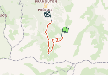

Length
7.4 km

Max alt
2559 m

Uphill gradient
54 m
Km-Effort
10.2 km

Min alt
1903 m

Downhill gradient
678 m
Boucle
No
Creation date :
2023-08-11 12:02:28.473
Updated on :
2023-08-11 14:26:29.529
2h23
Difficulty : Medium

FREE GPS app for hiking
 SityTrail
IGN / Geographical institutes
SityTrail Plus
The world is yours!
About
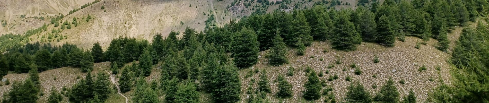
Trail Walking of 7.4 km to be discovered at Provence-Alpes-Côte d'Azur, Hautes-Alpes, Les Orres. This trail is proposed by lablaquiere.
Photos


Positioning
Country:
France
Region :
Provence-Alpes-Côte d'Azur
Department/Province :
Hautes-Alpes
Municipality :
Les Orres
Location:
Unknown
Start:(Dec)
Start:(UTM)
306939 ; 4926740 (32T) N.
Comments